Welcome to this post This post will provide you with information regarding the Air Traffic: Greenlight – Exporting custom locations and data fixes, and we hope you will find this material helpful.
Please find out how to export your individual holding fixes and waypoints, alter them in a text editor outside of the game, and then import the modified data back into it.
Intro
You can export or import your custom waypoints, holding fixed data, in JSON format. This allows for you to modify them via an external text editor.
This feature allows you to modify existing objects. It is not advised to export data from one source and import it from another.
Export
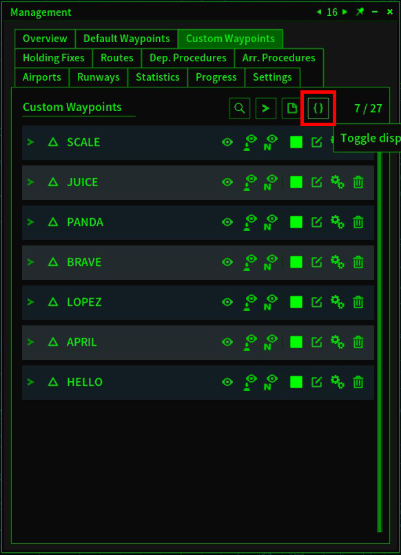
- Open the Custom Waypoints tab within the Management window.
- To open JSON toolbar click the
Button at the tab’s top-right
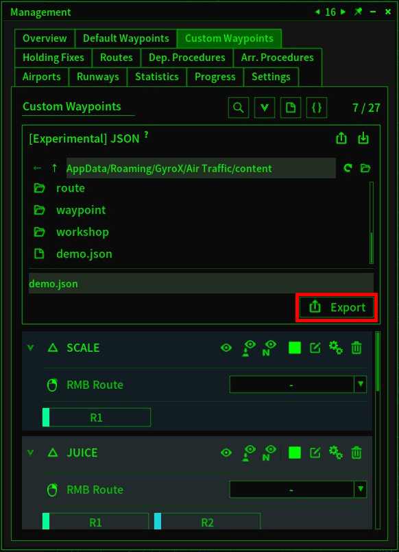
- Click on the
Export button in the toolbar.
Export
- A.json will be created at you specified path.
Import
- Open the Custom Waypoints tab within the Management window.
- To open JSON toolbar click the
Button at the top right of the tab.
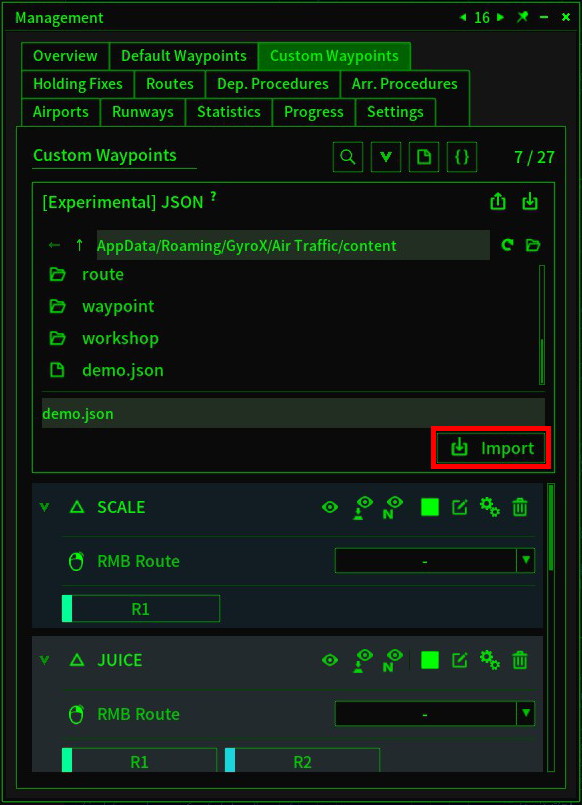
- Click on the
button to import.
Export button
Custom Waypoint
- The following example shows you how to create a JSON File that contains a custom Waypoint.
1 {
2 "0": {
3 "name": "SCALE",
4 "latitude": "N46 20 30",
5 "longitude": "E6 7 1"
6 }
7 }
| Line | Type | Name |
|---|---|---|
| 2 | String | id |
| 3 | String | Name |
| 4 | String | latitude |
| 5 | String | longitude |
- If the assignedID was used in the games, the existing object will not be modified. A new object will instead be created and given a different ID.
- It must be an int in string format.
- The existing object will not be modified if the assigned ID is used in the games. A new object will instead be created and given a different ID.
- If the assigned title has been used, a random name will be replaced.
- If the assigned title has been used, a random name will be replaced.
- N46 20’30”
- N46 20 30
- 46N 20 30
- 46 20 30N
- N46 20.5
- 46N 20.5
- 46 20.5N
- 46.341667
Holding Fix
- The following example shows an JSON file containing a holding fixed.
1 {
2 "0": {
3 "name": "FLOAT",
4 "lantitude": "S46 20 30",
5 "longitude": "W6 23 10",
6 "course": 174,
7 "direction": "R"
8 }
9 }
| Line | Type | Name |
|---|---|---|
| 2 | String | id |
| 3 | String | Name |
| 4 | String | latitude |
| 5 | String | longitude |
| 6 | Integer | Course |
| 7 | String | Direction |
- The existing object will not be modified if the assigned ID is used in the games. A new object will instead be created and given an ID.
- It must be an int in string format.
- If the assigned was used in the games, the object that has been modified will be deleted.
- If the assigned title has been used, a random name will be replaced.
- If the assigned title has been used, a random name will be replaced.
- S46 20’30”
- S46 20 30
- 46S 20 30
- 46 20 30S
- S46 20.5
- 46S 20.5
- 46 20.5S
- -46.341667
sexagesimal degree
- stands for degrees, minutes and seconds.
-
- However,
degrees and decimal minute
- are permitted.
Air Traffic: Greenlight – Exporting custom locations and data fixes is described in this guide. If you notice anything that needs to be fixed or updated, please let us know in the comments, and we’ll get to it as quickly as possible. May this be a good day for you. A big thank you to Fann for his post that inspired this guide. If you liked this post, you should check back regularly because we publish new information every day.
- All Air Traffic: Greenlight Posts List


Leave a Reply